
Schools & campuses
Translate building names, room numbers and multiple entrances into a shared view for the response team.
Turn your floor plans into useful response information. Connect an alarm to the building, entrance, floor and room, with an indoor route that helps people find the way.
Plus the entrance and the way inside.
Illustrative route. Mapping is scoped to your site.
01 / How it works
A street address gets help to the property. The details inside help responders understand which entrance to use, which floor to reach and where assistance is needed.
Start with your blueprints and floor plans. Standardize the rooms, doors, stairs and entries that matter to the safety workflow.
Bring the building, floor and available room information into the alarm context. Pin the entry and add access notes that are useful on arrival.
Make an indoor route part of the response view, connecting an entrance and stairwell to the destination. Review routes with the people who know the site.
02 / In view
Pair the building plan with the live safety connection. The map and pinned entry sit alongside the situation, so the person responding can understand both where and why help is needed.
Walk through it with us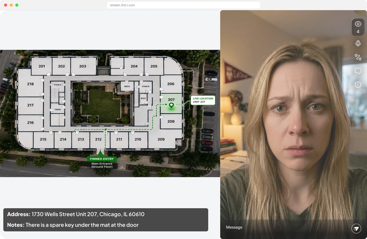
03 / Your team
Translate building names, room numbers and multiple entrances into a shared view for the response team.
Bring guest floors, service corridors and access instructions into planning for assistance on site.
Make unfamiliar floors and controlled entrances part of your emergency workflow before an incident occurs.
Start with your current floor plans, a building list and someone who can confirm entrances, room labels, stairs and access restrictions. We will review the materials and scope the digitization work.
No single accuracy figure should be assumed for every site. Building conditions, devices and connectivity affect the experience. Validate coverage and routing during deployment, including areas with weak connectivity.
Your emergency and evacuation procedures still need to be established for the property. Review the mapped routes with your safety and facilities teams, and keep them aligned as doors, access rules or floor layouts change.
Yes. Mapping is useful context for SOS and Command, and can also be part of a consulting engagement around access, wayfinding and dispatch handoffs. We will scope the workflow around your team.
Let’s build your program
Show us the buildings you cover. We’ll help turn the details into a clearer response.
Map your site with us