
Real-Time Location Tracking App: How to Choose Safely
You’re heading home after a late shift, and a friend asks you to share your location. You send the link, put your phone away, and assume they’ll notice if something goes wrong. But what happens if the dot stops moving, your battery runs low, or the pin points to the wrong entrance?
A real-time location tracking app can help someone follow your journey, but a moving dot isn’t a complete safety plan. What matters is how the phone reports its position, what your watcher can see, who can act, and what happens to your information after the trip ends.
Table of Contents
- How They Work
- Who Uses These Apps and What Each Group Needs
- Features to Compare Before You Download
- Permission Settings That Decide What Works
- Privacy, Consent and Legal Limits to Know
- When the Map Is Wrong and What to Do
- How to Choose an App You Can Trust
- Set Up and Test Your App Before Your Next Trip
How They Work
Think of location sharing as a relay, not a photograph. Your phone works out its position, sends an update to a server, and the server passes it to approved viewers. Each new update is another baton passed along the chain.
The phone’s location and the watcher’s map aren’t the same thing. Your device might have a fresh position while an interrupted upload leaves your friend looking at an older one.
The process looks like this:
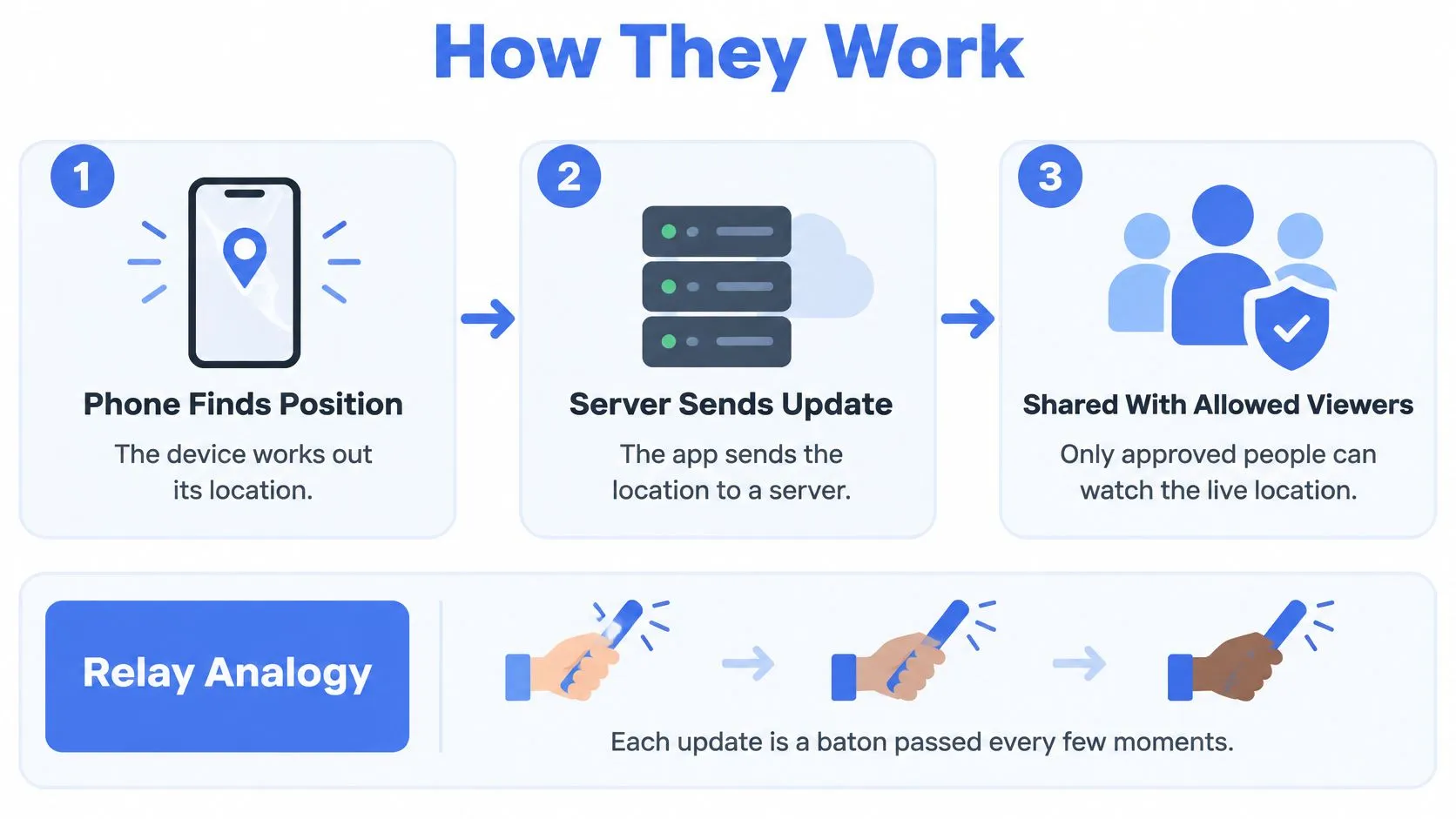
How the phone finds you
GPS receives satellite signals and generally works best with a clear view of the sky. Assisted GPS helps the phone acquire its first position faster, while Wi-Fi and cell information offer alternatives when satellite reception is poor.
Bluetooth establishes nearby-device proximity rather than independently locating you across a city. Dedicated indoor positioning can provide more useful building-level information where supporting infrastructure exists.
Location sources, accuracy and limits
| Method | Typical accuracy | Works best where | Main limit |
|---|---|---|---|
| GPS | A precise outdoor pin under favorable conditions | Streets, trails, open areas | Weak indoors and between tall buildings |
| Assisted GPS (A-GPS) | GPS-like precision with a faster first fix | Phones with mobile data | Assistance needs a data connection |
| Wi-Fi positioning | A local-area estimate | Indoors near mapped networks | Needs known networks nearby |
| Cell tower positioning | A broad-area estimate | Fallback when satellites are blocked | Shows an area, not an entrance |
| Bluetooth proximity | Nearby-device proximity | Wearables and nearby devices | Needs a compatible nearby device |
| Indoor positioning systems | Building-specific precision; our ELI Technology partner supports positioning within 5 to 10 feet | Equipped buildings, including low-connectivity interiors | Only where supporting infrastructure exists |
These are capabilities, not guaranteed outcomes. A phone can combine several inputs, and no single method stays best in every setting.
Emergency positioning is a separate system
Under U.S. Phase II wireless E911 rules, carriers had to supply wireless callers’ latitude and longitude when requested by an emergency answering point; the Federal Register’s FCC record also reports that device-based hybrid positioning served approximately 80% of wireless 911 calls in 2022, up from 17% in 2017.
That progress doesn’t make every consumer app emergency-grade. Emergency calling systems and an app’s sharing service have different delivery paths, permissions, and operational responsibilities.
At 3rd-i, our GPS feed shows the user’s current position and recent route. What a watcher receives still relies on the phone’s positioning, its connection, and successful server delivery. Outside the United States, confirm your local emergency number and whether the app’s dispatch connection operates in your country.
Who Uses These Apps and What Each Group Needs
Say your rideshare stops somewhere unexpected. A friend watching the route can see the stop, but they can’t tell whether you’re waiting at a traffic light or asking the driver to let you out. Scene visibility and someone available to act matter more than another map feature.
Different users need different kinds of support:
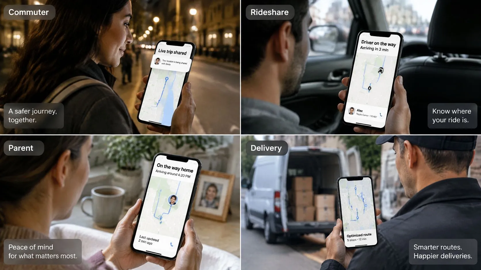
Match the features to the situation
- Individuals and students: A late walk or rideshare calls for a willing watcher, contextual video when appropriate, and a clear way to request help. Don’t assume a contact is watching just because they received an invitation.
- Families: A school commute needs an easy check-in and an agreed response to silence. A parent should know who calls the child first, rather than having several relatives assume someone else has done it.
- Lone workers: A home visitor or field technician needs scheduled check-ins, an available supervisor, and an escalation process that still works when the assigned watcher is busy.
- Campuses and traveling teams: Administrators need defined responsibilities and role-based access, not unrestricted visibility into everyone’s movements.
The scale of lone working makes this an operational issue: CDC’s National Institute for Occupational Safety and Health reported in 2024 that an estimated 53 million people work alone across the United States, Canada, and Europe, approximately 15% of the overall workforce. Safety Space’s guide to choosing a safety app for workers is a useful companion when turning individual tracking into a workplace procedure.
For a closer look at the service, watch this overview:
The practical question is the same for every group: Who has accepted responsibility for responding during this trip?
Features to Compare Before You Download
Core features compared on the same criteria
| Feature | What it does | Why it matters | What to check |
|---|---|---|---|
| Live route | Shows moving position and recent path | Reveals direction and progress | Updates continue when the app isn’t onscreen |
| Live video and audio | Streams camera and microphone to chosen viewers | Shows the scene, not only the location | Battery consumption and mobile-data use |
| Dual-camera streaming | Shares front and rear cameras together | Shows surroundings and the user’s face | Both views work in the floating window |
| Background tracking | Updates location while other apps are open | Supports uninterrupted trips | Background location permission is enabled |
| Check-in nudges | Prompts the user to respond | Reduces manual texting while walking | Replies need no typing |
| Human monitoring | Connects the user with trained staff | Provides someone who can assess and escalate | Staffing, contact methods, and emergency coverage |
| Recording and transcription | Preserves streams and produces an audio transcript | Supports later review | Retention, export rights, and transcript accuracy |
| Ghost mode | Temporarily hides the user from the map | Gives the user control over visibility | Exactly what pauses, including emergency sharing |
A route answers where movement is happening. Video can help answer what’s happening there, although neither proves that someone has understood the situation or requested help.
Our picture-in-picture feature keeps video and location live while you use Messages or Maps, and dual camera also works in the floating window. Our check-ins appear as map nudges that you answer with a location, stream, or status in a tap.
Compare what the watcher can actually do
Distinguish a notification service from human monitoring. An automated alert can tell someone to look; a staffed service needs a defined process for contacting the user, assessing context, and escalating.
Buying rule: Keep a feature on your shortlist only if it changes what the watcher can see or do during your actual journey.
Recording deserves separate attention. A saved stream can support follow-up, but a transcript or summary shouldn’t replace reviewing the original material when details matter.
Permission Settings That Decide What Works
An app can look ready while a missing permission blocks the function you need. Check settings on both the traveler’s phone and the watcher’s phone, because sending information and receiving an alert are separate jobs.
Permissions on the traveler’s phone
- Location: Enable precise location and the operating system’s background-access option, often labeled Always. Access limited to active use may not support the trip behavior you expect after switching apps or locking the screen.
- Camera and microphone: Allow these for live video, audio, and supported recordings. Without them, a watcher may receive a route without the scene or conversation.
- Bluetooth: Enable access if you use a compatible safety wearable. Pair the accessory and test its action rather than assuming a successful connection means its safety function works.
- Motion access: Review this if you want movement-based prompts. Our movement detection can prompt you to go live during the hours you set.
In our app, precise background location supports Trip Mode, SOS, and Squad location sharing. Denying location access prevents Trip Mode, precision SOS sharing, and related Safety Agent functionality from working as intended.
Camera and microphone access enables live streaming, Dual Camera Mode, and Safety Agent recordings. Permission is permission to use the hardware, not proof that a stream has successfully reached its viewer.
Alerts on both phones
Notifications need their own test. Check whether an invitation, check-in, and emergency alert arrive while the watcher’s screen is locked.
Where supported and authorized by the operating system, Critical Alerts can reach contacts through Do Not Disturb. Ordinary notification permission doesn’t automatically establish that this exception is enabled.
A successful test includes the receiving phone. Your own screen showing “sent” isn’t enough.
After an app or operating-system update, reopen settings and verify that the intended permissions remain enabled. Also inspect battery restrictions if the trip works onscreen but stops updating in the background.
When a watcher reports no location at all, check location permission and device location services first. If those are correct, investigate connectivity and whether the trip is running before changing unrelated settings.
Privacy, Consent and Legal Limits to Know
More precise tracking isn’t automatically safer. A detailed route helps an authorized watcher, but it also exposes more if an account is compromised or a former contact retains access.
Location sharing is common enough to deserve deliberate controls: a Digital Journal account of a 2024 HostingAdvice survey reports that 51% of 1,015 U.S. consumers shared their location with third-party apps. That finding doesn’t establish how safely those apps handled the information.
Follow the information after the trip
Data lifecycle questions for each stage
| Stage | Question to ask the provider |
|---|---|
| Collection | Is only location collected, or also video, audio, and device identifiers? |
| Active sharing | Who sees the live dot, and does sharing stop automatically when the trip ends? |
| Recording | Is recording visibly flagged, and can it be switched off? |
| Retention | How long are routes, video, audio, transcripts, and emergency records kept, and are they kept separately? |
| Deletion | Can users delete individual items, and what remains after account deletion? |
| Access logs | Can users see who viewed or exported their information? |
| Third-party disclosure | Which monitoring or dispatch partners receive data, and under what terms? |
| Account recovery | Could someone recovering the account access historical location? |
Emergency information may cross organizational boundaries, an important consideration alongside the system changes discussed in Contact Center Pipeline’s NG911 overview. Don’t assume ending a trip deletes information already recorded or transferred.
Make access a deliberate choice
Tell people they’re being tracked, and obtain appropriate local advice before monitoring employees or minors. Account ownership alone isn’t a substitute for understanding consent and applicable law.
Our users can turn off GPS tracking at any time, after which the third party tracking them stops receiving their location. A Squad member may join streams and trips, view their recordings, and track location during use only with the user’s permission.
Review our Ghost mode controls alongside your watcher list. Treat time-limited sharing, visible recording status, and removal of former contacts as safety controls, not administrative housekeeping.
When the Map Is Wrong and What to Do
A live dot is context, not proof of position. A useful monitoring screen should distinguish live, delayed, stale, and offline, with the time of the last location fix visible. A recently delivered update might still contain an old position.
The FCC’s location-based-routing rules require location-based routing for wireless 911 voice calls or real-time text when the caller can be located within a 165-meter radius at a confidence level of at least 90%; otherwise, providers use the best available information. That’s an emergency-network routing threshold, not a consumer-app accuracy promise.
Symptoms, likely causes and what to do
| Symptom | Likely cause | What to do |
|---|---|---|
| Map frozen on last pin | Network loss or operating-system suspension | Check the timestamp, call or text, then contact the fallback person |
| Pin off by one building | Reflected GPS signals or an approximate fix | Use the entrance or room note and request a landmark |
| Route stops in a tunnel or elevator | Satellite reception and data are unavailable | Preserve the last known fix and note its age |
| Accuracy suddenly drops | Power restrictions or approximate-location settings | Check precise location and battery settings |
| Stream lags or drops | Weak cellular or Wi-Fi connection | Follow location if available and try a voice call |
| No location at all | Permission denied or device location switched off | Contact the user directly; call emergency services if there’s danger |
Give responders an entrance, not just a pin
A useful emergency location includes a street address plus the building, floor, apartment, office, or room. The GPS pin may sit near the back of a building while responders need the front entrance and an access code.
Transport hubs make this distinction especially clear. Airport Vans NYC’s JFK airport pickup planning tips offer useful arrival-planning context: agree on the terminal and meeting point rather than relying only on overlapping dots.
We don’t guarantee the precision, reliability, or real-time accuracy of location data. Settings, surroundings, connectivity, GPS limitations, third-party systems, and technical constraints can make it delayed, approximate, inaccurate, or unavailable.
The watcher’s stale-map procedure
- Read the timestamp. Record when the last reliable position was obtained, not merely when you refreshed the screen.
- Call or text the traveler. Ask for a landmark, entrance, room, or travel direction if they can safely respond.
- Keep the last reliable fix. Combine it with the recent route and entry instructions, without presenting it as a confirmed current position.
- Contact the fallback person. Share what’s known and what remains uncertain.
- Call emergency services directly when there’s danger. Don’t wait for the dot to move or assume an in-app alert completed an emergency handoff.
Never postpone an emergency call to troubleshoot a map.
For routine problems when everyone is safe, use our location accuracy troubleshooting guidance. During an incident, prioritize actionable location and direct communication over restoring video.
How to Choose an App You Can Trust
Choose a real-time location tracking app by checking the same practical questions for every candidate. Don’t let a polished map substitute for evidence that the service works on your devices, routes, and monitoring arrangements.
Use this checklist to keep comparisons consistent:
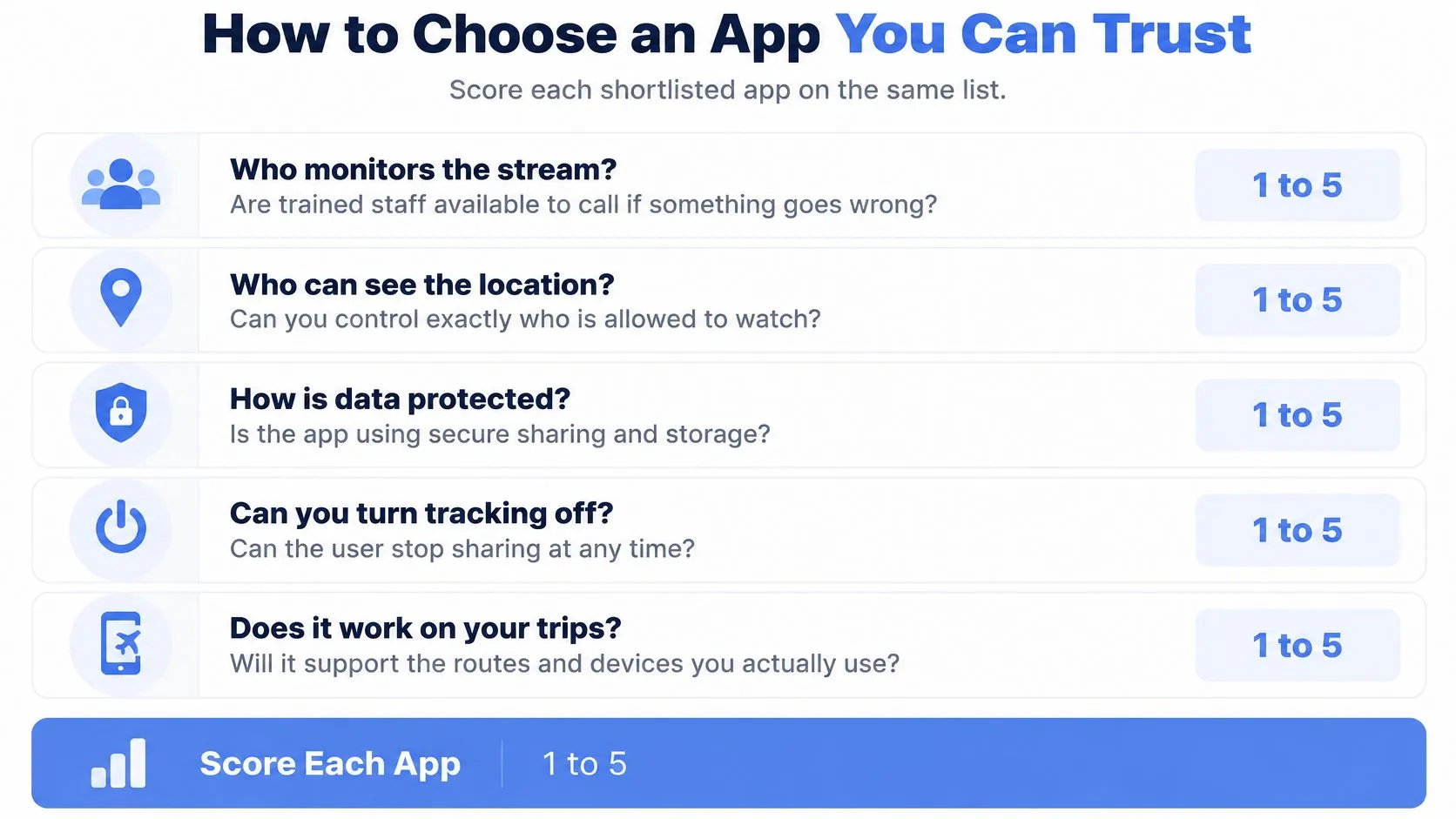
Separate promises from usable coverage
- Monitoring: Are people available to call, chat, assess both camera views, and escalate, or does the service only send automated alerts?
- Emergency handoff: What reaches dispatch, in which countries, and through which integration? Our service uses RapidSOS for emergency coordination, but the app isn’t a substitute for calling emergency services.
- Device support: Can the traveler start the required functions on their phone, and can their chosen watchers receive them on theirs?
- Administration: Can an organization assign responsibilities without giving every administrator unnecessary access?
- Plan structure: Are streaming and recording minutes shared across a household, and is human monitoring included?
- Data handling: Are retention, deletion, access, and disclosure terms available in writing?
Our Safety Agent monitoring and 911 escalation are included on every individual plan. For institutions and enterprises, we support Organization groups with designated administrators and a dedicated Security Center panel.
For employers assessing the wider response arrangement, Opus Safety’s guidance to compare health and safety consultants can help distinguish software procurement from the separate need for competent safety advice.
Keep a small shortlist and mark each answer confirmed, unconfirmed, or unavailable. An unconfirmed capability shouldn’t count as protection, especially if your family or workplace procedure depends on it.
Set Up and Test Your App Before Your Next Trip
Test in a familiar, safe area with a friend who has agreed to watch. Use the provider’s documented test process, and never trigger a real emergency response just to experiment.
Keep this setup guide beside you:
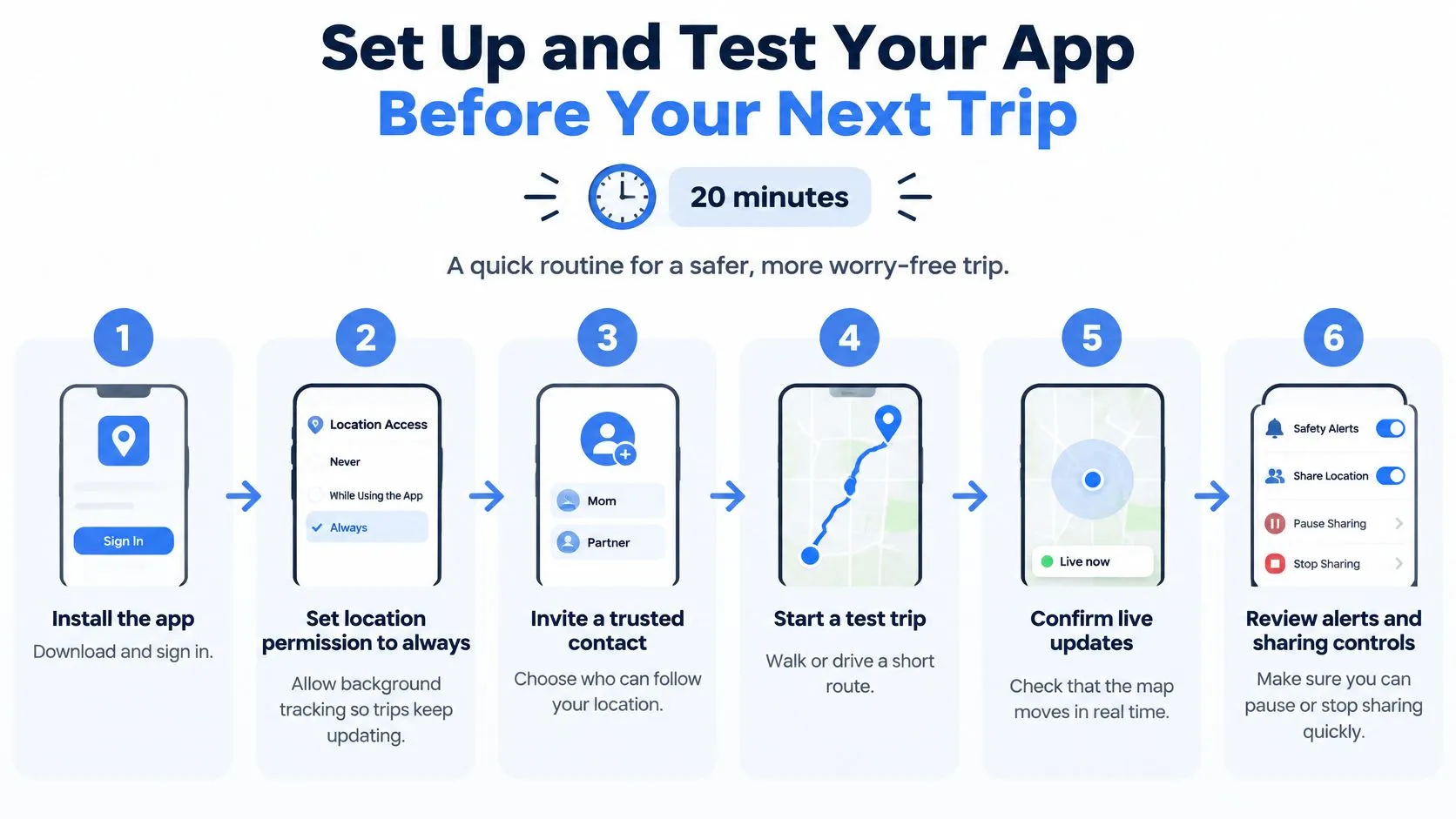
Run the trip from both ends
-
Install and configure. Sign in, enable the required background and precise-location access, and review the remaining permissions. Confirm the app indicates that your trip has started.
-
Invite trusted contacts. Decide who may see the route, video, and history, then remove anyone who no longer needs access. For mixed-device households, follow our guide to sharing location from iPhone to Android.
-
Take a real test walk. Lock the screen, switch to Maps, and ask your friend whether new positions continue arriving. Send a check-in response and verify receipt rather than relying on your own confirmation screen.
-
Arrange an authorized SOS test. Coordinate with the service before testing monitoring or emergency functions. Our SOS action shares livestream, audio, and location with a trained safety dispatcher and starts text communication; verify the supported test procedure for both cameras.
-
Write down the post-incident rules. Our RapidSOS integration may continue limited post-incident location sharing for up to an additional 30 minutes. Separately establish the recording-retention terms so nobody confuses ending an incident with deleting its records.
-
Rehearse an interrupted trip. Agree who contacts the traveler, who calls the fallback person, and who requests emergency help. Finish by stopping sharing and confirming what the watcher can still access.
Repeat the practical checks after operating-system updates and meaningful settings changes. Don’t make your next late-night journey the first time anyone discovers how your chosen app behaves.
3rd-i offers live video, audio, and route sharing with selected contacts, plus trained Safety Agents who can coordinate emergency escalation. Visit 3rd-i to review the service, choose your watchers, and plan a safe test walk before relying on it for your next trip.