
10 Location Sharing Apps for Android and iPhone in 2026
A student leaves the library after dark, a parent waits for a teenager to confirm they’re home, and a lone worker finishes a shift with no colleague nearby. In each case, location sharing can help, but the right tool depends on the job. A short meetup needs a temporary link. A family may want ongoing check-ins. Friends may prefer a live update inside a chat. A lone worker may need monitoring, evidence capture, and emergency escalation, not just a moving dot on a map.
This list is organized by use case and audience. Each entry explains where the app works well, what it can’t do, and where Android or iPhone support, paid features, or regional pricing need checking. Before relying on any service, verify its current platform support, pricing, permissions, and emergency features on the vendor’s site. Location sharing also exposes more than a pin. Google says recipients may see a sharer’s name, profile photo, recent device location, battery status, and configured arrival or departure information, so review access carefully in Google’s location-sharing guidance.
For broader personal protection beyond location sharing, you can also secure your identity with MY CYBER GUARD.
Table of Contents
- 1. 3rd-i for safety escalation and monitored journeys
- 2. Life360 for always-on family tracking
- 3. Google Maps for mixed-device meetups
- 4. WhatsApp for chat-based check-ins
- 5. Telegram for group location broadcasts
- 6. Snapchat for younger friend groups
- 7. Glympse for temporary location links
- 8. iSharing for lighter family tracking
- 9. GeoZilla for family alerts
- 10. Find My Kids for child-focused tracking
- Top 10 Location-Sharing Apps Comparison
- Matching Your Situation to the Right Location Sharing App
1. 3rd-i for safety escalation and monitored journeys
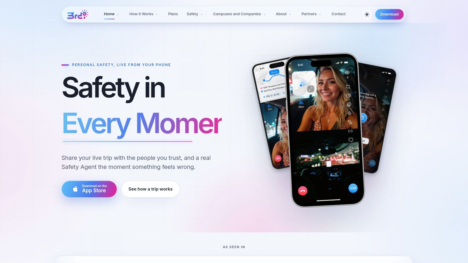
3rd-i suits a different job from family map apps or one-time meetup links. It is built for cases where someone may need active oversight during a journey, with more context than a pin on a map. On iPhone, the app can share live video, audio, and route information with chosen contacts and trained Safety Agents. That matters when a student is crossing campus at night, a lone worker is finishing a shift, or someone is getting into a rideshare and wants another person to see what is happening, not just where they are.
Best fit: People who need live oversight, human monitoring, and a path to emergency escalation, not just family location sharing.
The practical difference is how much situational detail it carries. A user can stream from the front or rear camera, switch on picture-in-picture, and share the session with a private Squad that sees a watcher count. One-tap Nudges and replies help when typing would be awkward or unsafe. Lock Screen widgets speed up access to Go Live and SOS. Features such as movement prompts, Critical Alerts, Ghost mode, and an Emergency Entry Pin give users more control over how visible and reachable they are during a trip.
Its clearest advantage is the monitored response layer. Safety Agents can call or chat, view both cameras, and escalate to 911 through RapidSOS with the live context they can see. Automatic recording, transcription, and AI summaries also create material for follow-up. That is useful for incident records and review, which chat apps and general-purpose family trackers usually do not provide.
Where 3rd-i needs careful checking
3rd-i currently ships an iOS availability option, so Android users should confirm current support before choosing it for a mixed-device group. Watchers should also check how browser access works on their own setup before relying on it in a real situation. The service uses metered streaming and recording minutes across Solo and Family Basic, Plus, and Pro tiers. Campus and Company deployments use centrally issued seats and pooled minutes. Current pricing is not published here, so confirm consumer, campus, or volume costs directly with 3rd-i.
This app is a stronger fit for safety escalation than casual coordination. It can add monitoring, evidence capture, and a route to emergency response. It cannot replace your own judgement or the need to contact emergency services directly when you can. For a simple “meet me here” use case, it is more than many people need.
2. Life360 for always-on family tracking
Life360 is built around persistent family location sharing. Families create Circles, view participating members on a shared map, and set place alerts for routines such as home, school, or work. It also adds driving-related services, crash detection, roadside assistance, location history, and Tile integration for tracking compatible items alongside people.
That breadth is useful for families that want one household safety ecosystem rather than a separate app for every task. A parent can use ongoing location sharing for everyday coordination, while a driver may value crash-related or roadside features. The experience is more structured than sending a one-time location from a messaging app.
Life360 works best when everyone agrees that ongoing visibility is useful. It’s a poor fit when people only need occasional, purpose-bound sharing.
The main trade-off is the subscription structure. Advanced features, including longer history and some crash or roadside services, depend on the plan. Check the current plan page for exact inclusions, because feature availability and offers can change by market. Always-on tracking can also affect battery life, especially when users leave background permissions restricted or enable aggressive battery-saving settings.
Life360 isn’t a professional monitoring service for lone workers. It doesn’t turn a routine family map into an incident record with live video, trained observers, or formal dispatch coordination. It’s also not the most private choice for a single meetup, since a temporary link or chat-based share may expose less information for a shorter period.
3. Google Maps for mixed-device meetups
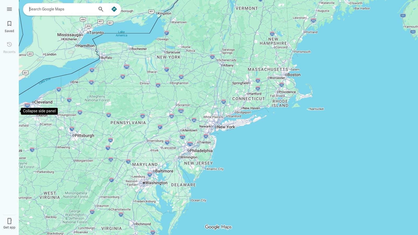
Google Maps is the practical default for many ad-hoc situations. A user can share real-time location with selected people for a chosen period or until sharing is stopped. It works across Android and iPhone, which matters because those two systems represented approximately 69.17% for Android and 30.81% for iOS of worldwide mobile operating-system usage in the cited StatCounter measurement, a combined 99.98% of tracked usage (StatCounter).
That figure is a market-share estimate, not a count of people and not a measure of active location sharing. Its practical message is simpler: mixed-device groups are normal. A student with an Android phone may need to share with an iPhone user, or the other way around, so cross-platform access should be tested rather than assumed.
Google Maps is well suited to meeting friends, coordinating a trip, or letting a parent follow a route for a limited period. It also supports controls for individual recipients and can show information such as recent location and battery status when configured. For a deeper look at live route visibility, compare it with 3rd-i live location sharing, which adds live video and monitored safety workflows.
What Google Maps can’t do
Google Maps doesn’t provide built-in professional monitoring, human Safety Agents, or emergency escalation. It also isn’t a dedicated family-safety dashboard with formal incident records. Sharing depends on an active internet connection, device location access, and the correct account and permission state, as described in Google’s account location-sharing requirements.
Use it when you need simple, free, cross-platform sharing. Don’t treat a moving map marker as proof that someone is being watched continuously, especially during weak connectivity, battery restrictions, or a denied background permission.
4. WhatsApp for chat-based check-ins
WhatsApp makes location sharing easy when a group already coordinates inside the same chat. From a one-to-one or group conversation, users can send a static current location or start a live location share for a selected period. That makes it useful for “I’m on my way,” a friend walking to a venue, or a family member sharing progress during a short trip.
The main strength is low friction. People don’t need to build a separate family circle or learn a dedicated safety dashboard. Live shares expire, and the recipient can respond in the same conversation. WhatsApp messages also use end-to-end encryption, although that doesn’t eliminate the need to review who belongs to the chat or what information a live share reveals.
Use WhatsApp when the conversation is the coordination layer. Don’t use it as a substitute for monitoring or emergency response.
WhatsApp isn’t a full family locator. It doesn’t provide a persistent family map, formal location history, geofenced arrival alerts, professional dispatch, or incident records. A recipient may see a static point or a live update, but the app won’t independently verify that the person arrived safely.
Background updates can also pause when operating-system battery controls restrict the app. Android and iPhone permissions differ, and the sender still needs location access, mobile data, and a functioning device. Test a live share with the screen locked before relying on it for a late journey.
5. Telegram for group location broadcasts
Telegram suits groups that already use Telegram and want live location inside an existing conversation. Users can share live geolocation for a selected period, including common short, medium, and extended sharing windows, and can use proximity alerts when contacts approach a chosen radius.
That makes Telegram useful for festivals, group walks, travel coordination, and student groups. Participants can keep the discussion, directions, and location update in one place. Cross-platform availability is a practical advantage for groups that mix Android and iPhone users.
Telegram requires background location permission for continuous updates. That permission may concern users who only intended to share for a single journey, so explain the duration and stop the share when the activity ends. Update frequency can also vary in practice when connectivity or battery controls interfere.
The app isn’t designed as a family safety system. It doesn’t provide built-in crash response, trained monitoring, 911 escalation, or a structured incident record. Proximity alerts help with coordination, but they don’t create a reliable emergency workflow.
For students, friends, or event groups, Telegram can be enough when everyone is actively watching the chat. It’s less suitable for a parent who needs recurring place alerts or an employer responsible for a lone worker after dark. Check current permission behavior on both operating systems before treating a group broadcast as continuous oversight.
6. Snapchat for younger friend groups
Snapchat works for users who already spend time in the app and want friend-level control over location visibility. Snap Map can show a location to selected friends, while live location sharing can provide more immediate updates. Ghost Mode lets users hide their location, and per-friend controls can limit who sees it.
That combination suits teenagers, college students, and friends coordinating at a large venue. The visual map is familiar, and users can change visibility without adopting a separate family-tracking product. A useful privacy practice is to decide whether sharing is for a specific person, a temporary activity, or a broader friend list before enabling it.
A social map can support coordination, but it shouldn’t be mistaken for a safety response system.
For readers comparing privacy controls, this guide to Ghost mode illustrates the broader principle of making location visibility reversible and understandable. Users should know who can see them, whether sharing is active in the background, and how to stop it.
Snapchat isn’t suitable for formal workplace oversight or emergency management. It doesn’t provide dispatch, professional monitoring, structured incident records, or a dedicated family safety workflow. The social context may also be inappropriate for employers or families who need clear accountability.
Battery optimization, denied permissions, and poor connectivity can affect updates. Parents should discuss consent and boundaries rather than treating a social app as a surveillance tool. Students should also verify whether the intended friend group can access the same location features on their current Android or iPhone version.
7. Glympse for temporary location links
Glympse is built around a simple question: who needs to see your location, and for how long? A user sends a time-limited live-location link, and the recipient can view it through a web browser without installing the app. That’s valuable when a friend, customer, family member, or event contact doesn’t want another app.
It works well for airport pickups, deliveries, road trips, appointments, and meeting someone in an unfamiliar place. The sender can set a duration, extend it when needed, and attach notes or messages. The link expires when the share ends, which is more privacy-conscious than leaving a family map active indefinitely.
The limit of an expiring link
Glympse isn’t an always-on family tracker. It doesn’t provide recurring home and school alerts, a persistent family history, formal monitoring, or emergency dispatch. It also doesn’t prevent an active viewer link from being forwarded, although access ends when the share expires.
That distinction matters. A temporary share is appropriate when the recipient only needs trip progress. It’s not enough when a campus safety team needs a monitored journey, or when an employer needs evidence and escalation for a lone worker.
Glympse also depends on the sender’s phone, permissions, and connection. If the device stops updating, the recipient needs a clear understanding that the last visible position may be stale. Before a long journey, send a test link to the intended viewer and confirm that it opens without an app installation.
8. iSharing for lighter family tracking
iSharing offers family Circles, live location, place alerts, location history, and driving summaries. It’s aimed at households that want a dedicated family locator without necessarily adopting the broader ecosystem associated with larger safety platforms.
The Circle model keeps setup straightforward. Parents, partners, or caregivers can group trusted members and view agreed location information in one place. Place alerts help with routine coordination, such as knowing when someone leaves home or arrives at school, work, or another saved location.
Paid tiers include Silver, Gold, and Platinum options alongside a free plan. Advanced history and driving features may depend on the selected tier, so confirm the current plan details in the relevant app store and on the vendor’s site. Regional storefronts can display different prices or offers.
iSharing isn’t a professional incident-response tool. It doesn’t provide live video to trained Safety Agents, formal dispatch escalation, or evidence capture designed for post-incident review. It’s also not the best choice for a one-time meetup, where a time-limited link shares less ongoing information.
Continuous tracking requires attention to battery settings. If the phone restricts background activity, location updates may become delayed or stop. Agree on who can see each Circle, how long sharing remains active, and what happens when a member wants to pause it.
9. GeoZilla for family alerts
GeoZilla focuses on a family map with live location, arrival and departure notifications, location history, battery alerts, and premium subscriptions. It suits families that care about routine place-based updates rather than only opening a map when someone sends a link.
A parent may want an alert when a child leaves school, while partners or caregivers may use battery notifications to identify a phone that could soon stop reporting. A subscription can cover invited family members, but current pricing and promotional offers vary by region and storefront. Review the exact offer before subscribing.
What GeoZilla doesn’t replace
GeoZilla isn’t a dispatch service or a human monitoring operation. It doesn’t turn a geofence alert into an emergency response, and it doesn’t create the live video, audio, or objective evidence that a safety platform may provide. A place alert can tell you that a device crossed a boundary, but it can’t explain why.
That makes GeoZilla a reasonable fit for families with predictable routines and a shared agreement about ongoing tracking. It’s less appropriate for a lone worker, a campus escort, or a person who needs a watcher to intervene during a dangerous journey.
As with every background location app, test the experience on both Android and iPhone if your household is mixed. Check location permission, notification access, battery optimization, and the behavior after the app is force-quit. A stale location should be treated as an unresolved status, not as confirmation that someone is safe.
10. Find My Kids for child-focused tracking
Find My Kids is designed for parents who want child-focused location tools. It supports live location, timelines, place alerts, SOS, battery status, and a companion child app called Pingo. Some setups can also use a loud signal to reach a child’s phone when the phone is muted.
That feature set is more specialized than a general family map. Parents may value clear onboarding, safe-zone alerts, and a way to request attention when a child doesn’t answer. It can suit younger children who carry a phone or use a compatible GPS watch, subject to current device support.
The trade-off is intrusiveness. A loud signal and persistent tracking may help with safety, but older children may reasonably want more autonomy. Families should agree on what is shared, who receives alerts, and when the arrangement will be reviewed. For broader context on choosing devices for children, see these best refurbished iPhones for children.
Premium capabilities require a subscription, and the exact feature set can change by plan, device, country, and storefront. Confirm the current trial and payment terms before setup. The app also needs careful permission management because child-location tools depend on background access, network connectivity, and battery availability.
Find My Kids isn’t intended for formal campus operations, employer lone-worker protection, or professional emergency dispatch. It can support family check-ins, but it doesn’t replace calling emergency services or using a monitored safety platform when an incident requires intervention. Families considering a more active safety workflow can compare it with this family tracking app approach.
Top 10 Location-Sharing Apps Comparison
| Product | Core features | UX & quality | Unique selling points | Target audience | Price / Value |
|---|---|---|---|---|---|
| 3rd‑i 🏆 | ✨ Live dual‑cam + live route, Safety Agents, RapidSOS, auto‑record & AI summaries | ★★★★☆ Agent‑monitored, iOS focused | ✨ Human‑in‑the‑loop escalation; evidence capture & transcript | 👥 Individuals, families, campuses, employers (late walks, lone work) | 💰 Metered minutes (Solo/Family/Campus); contact for quotes |
| Life360 | Real‑time location, crash detection, roadside assistance (premium) | ★★★☆☆ Mature, scalable | ✨ Family ecosystem, Tile integration | 👥 Families wanting always‑on tracking | 💰 Free → Premium tiers (paywalled features) |
| Google Maps (Location Sharing) | Cross‑platform live location, duration control, per‑contact sharing | ★★★★☆ Reliable, widely installed | ✨ Built‑in app, no extra install, fine‑grained controls | 👥 General users for ad‑hoc meetups & trips | 💰 Free |
| WhatsApp (Live Location) | Live Location in chats, time‑limited shares, E2E encrypted | ★★★★☆ Simple, chat‑native flow | ✨ End‑to‑end encryption, auto‑expire shares | 👥 Friends & groups coordinating in chat | 💰 Free |
| Telegram (Live Location) | Live location sharing, proximity alerts, background updates | ★★★☆☆ Flexible, cross‑platform | ✨ Proximity alerts inside chats | 👥 Telegram groups/users preferring its features | 💰 Free |
| Snapchat (Snap Map) | Snap Map, live location sharing, per‑friend controls, Ghost Mode | ★★★☆☆ Youth‑focused, social map | ✨ Familiar map UI for teens, Ghost Mode | 👥 Teens & college students | 💰 Free |
| Glympse | Time‑limited link‑based live location (no viewer app required) | ★★★★☆ Easy for recipients, ad‑hoc friendly | ✨ Web link sharing, strong temporary privacy | 👥 People coordinating ETAs or short trips | 💰 Free |
| iSharing | Family Circles, location history, driving summaries (by plan) | ★★★☆☆ Simple setup, lighter than Life360 | ✨ Circles + multi‑tier pricing | 👥 Families wanting a lighter family locator | 💰 Free + paid tiers |
| GeoZilla | Family map, geofence alerts, battery/status notifications | ★★★☆☆ Straightforward family GPS UX | ✨ Companion tracker option, one subscription can cover family | 👥 Families needing geofencing & cross‑platform support | 💰 Subscription‑based |
| Find My Kids | Real‑time tracking, geofences, SOS, loud signal, kid app (Pingo) | ★★★☆☆ Parent‑focused onboarding | ✨ Kid‑centric tools (loud signal), SOS from child device | 👥 Parents of young children | 💰 Trial → subscription |
Matching Your Situation to the Right Location Sharing App
Start with the purpose, not the feature list. If someone only needs to show progress to a friend during a short trip, a time-limited Glympse link is usually more appropriate than an always-on family tracker. The recipient doesn’t need to install the app, and access ends when the share expires.
For ongoing family check-ins, choose a family locator such as Life360, iSharing, GeoZilla, or Find My Kids. These tools are designed for Circles, place alerts, history, battery visibility, or child-focused routines. The right choice depends on whether you need driving services, child controls, longer history, or a simpler interface. Check which capabilities require a paid tier before adding every family member.
Chat-based sharing works when the group already communicates through WhatsApp, Telegram, or Snapchat. It’s fast and familiar, but the sender still needs to start the share and the recipient still needs to pay attention. These apps aren’t built for dispatch, formal monitoring, incident records, or guaranteed continuous oversight.
Location alone isn’t enough for a late-night walk, rideshare, campus escort, or lone-worker shift. In those cases, 3rd-i’s combination of live route, live video, human Safety Agents, emergency escalation through RapidSOS, and automatic recording addresses a different requirement. It provides context and a response path rather than only showing where a phone was last detected.
Before relying on any app, run through this short check:
- Test both platforms: Confirm the complete sharing flow on Android and iPhone if the group uses both.
- Check background access: Review location permissions, notification access, mobile data, and battery-saving behavior.
- Review visibility: Confirm who can see the location, whether battery or history is included, and when access ends.
- Check current pricing: Verify vendor pricing, regional offers, plan limits, and paywalled features directly.
- Test failure states: See what the recipient sees when the phone loses signal, the app is closed, or permissions change.
- Keep emergency options clear: No location app replaces calling emergency services when immediate help is needed.
Privacy deserves equal attention. Research reports that more than 90% of smartphone owners use location-based services, while 63% of smartphone and tablet users are uncomfortable disclosing location (the cited review). That tension is why temporary sharing, visible session status, clear recipient controls, and fast revocation matter. A trusted app is one that makes sharing understandable and stoppable, not one that collects the most information in the background.
3rd-i combines live video, audio, and route sharing with selected contacts and trained Safety Agents for late walks, rideshares, campus travel, family check-ins, and lone-worker situations. If a moving location dot isn’t enough, visit 3rd-i to review its monitored Go Live, emergency escalation, and evidence-capture options.