
Remote Finder App Guide: How It Works and What to Pick

You’re walking home after dark, checking the map on your phone, when you realize you can’t find it. Or perhaps you’re trying to choose a tracker for a child, an older relative, a rideshare passenger, or an employee working alone. The phrase remote finder app sounds like one category, but it hides several very different jobs.
Some tools help recover a misplaced object. Others locate a connected phone. A smaller group provides continuous visibility, human monitoring, and emergency escalation while someone is moving. Choosing correctly starts with separating those jobs.
Table of Contents
- What a Remote Finder App Actually Does
- How Remote Finder Apps Locate a Phone
- Object Trackers, Phone Finders, and Safety Apps Compared
- Key Features to Evaluate Before You Install
- How Safety Apps Go Beyond a Map Dot
- Where Remote Finder Apps Quietly Break
- Choosing the Right Solution for Your Situation
- Making a Confident Final Choice
What a Remote Finder App Actually Does
A remote finder app is a mobile tool that locates something at a distance. That “something” might be a key, bag, phone, or person. The important question isn’t merely whether an app shows a map. It’s what the app is designed to locate, how often it updates, and who responds when the location becomes concerning.
A Bluetooth tag attached to a keyring has a different purpose from a phone-finding service. A personal safety app has a different purpose again. Treating all three as interchangeable creates false confidence, especially when someone is travelling, working alone, or unable to interact with their device.
Keep this three-job model in mind:
- Recover a lost object, such as keys, a bag, or a remote.
- Locate a connected phone, usually through its built-in account and location services.
- Obtain continuous human oversight, with live movement, communication, and escalation when needed.
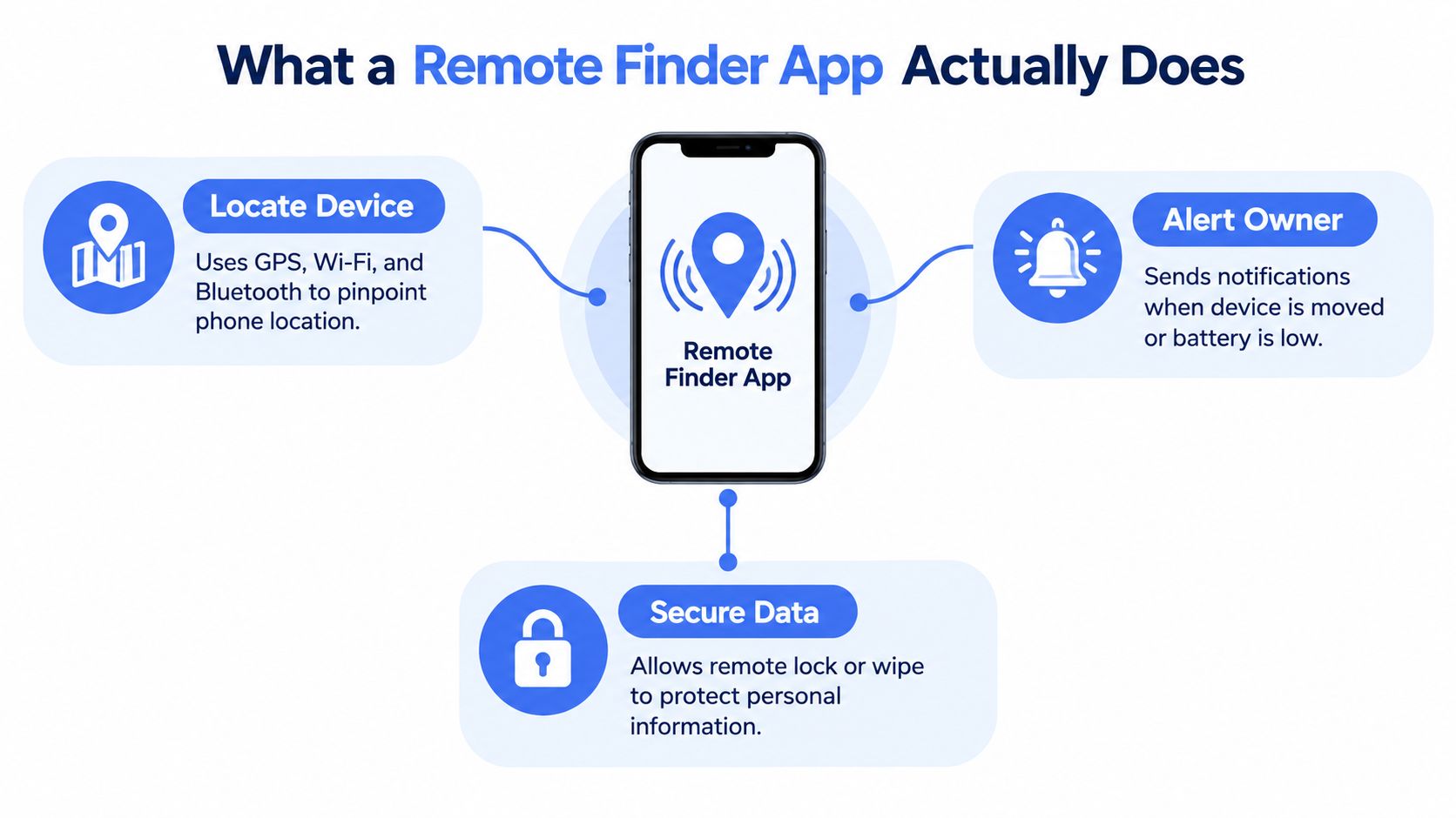
The distinction matters in practical situations. If you’ve lost a key fob in your home, a nearby Bluetooth signal and a sound may be enough. If you’ve misplaced your phone, account-based device finding can show its last available location, make it ring, or help secure its contents. If someone is travelling through an unfamiliar area, a map dot alone may not tell anyone whether they’re safe.
Physical access can also be part of the wider safety workflow. For buildings, an option such as a cellular gate entry app may help an authorized person reach a location without depending on a traditional access method. It doesn’t replace location sharing or emergency monitoring, but it illustrates why finding a person and reaching that person are separate operational problems.
How Remote Finder Apps Locate a Phone
Most phone-finding systems combine several signals rather than relying on one magical positioning method. Bluetooth works over a short distance and is useful when a tagged item or phone is nearby. It’s like a key hook beside the front door. It can tell you that something is close, but it won’t provide a continuous route across town.
GPS and other satellite-based positioning work more like a street address. Outdoors, a phone can estimate its position from satellite signals and send that information through a mobile or Wi-Fi connection. GPS is useful for movement and route sharing, but buildings, dense urban areas, weather conditions, battery limits, and blocked signals can reduce freshness or precision.
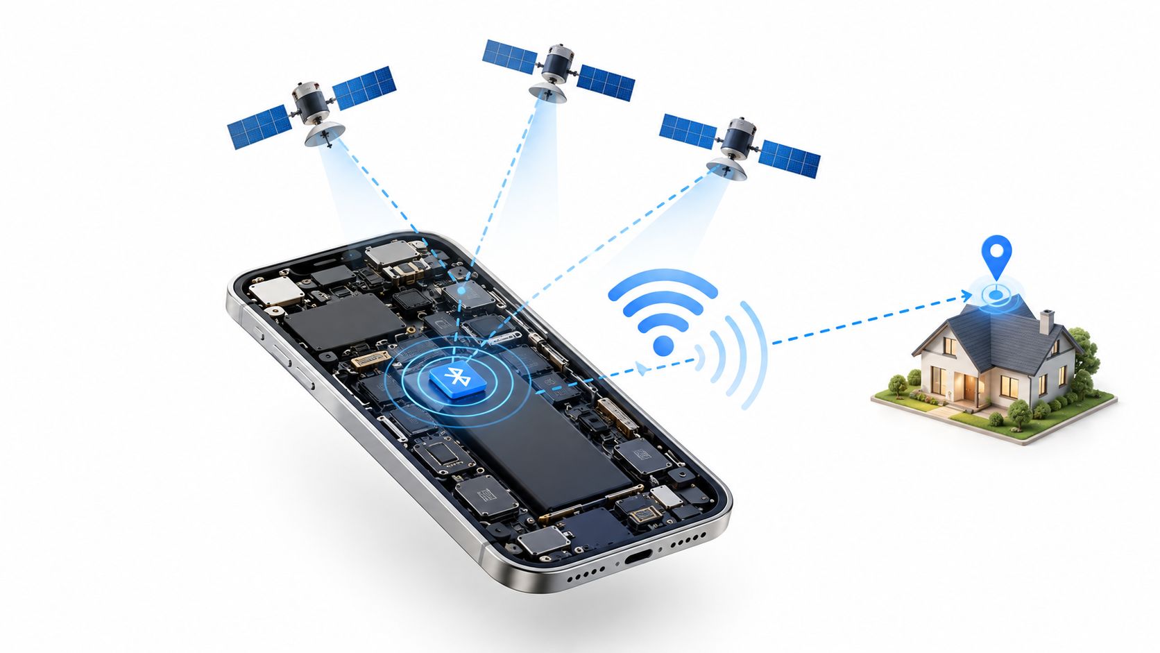
Wi-Fi positioning adds context by comparing nearby networks with known locations. Cellular positioning can provide a broader estimate when satellite signals are weak. A well-designed app combines these inputs with device motion, timestamps, and a clear indication of whether the current fix is fresh or stale. You can read more about the practical side of improving location accuracy when a map point doesn’t match what’s happening on the ground.
The network effect
Networked finders use participating phones as relays. If a tagged object is away from its owner, another nearby phone may detect the signal and pass an approximate location to the service. The analogy is asking every neighbour whether they’ve seen your cat. It can help in a busy area, but it depends on nearby participating devices, permissions, connectivity, and the environment.
That’s why every layer has an accuracy floor. Bluetooth is local, GPS is strongest when the phone can see the sky, Wi-Fi and cellular signals provide supporting estimates, and crowdsourced networks depend on other devices being present. None of these automatically creates a live conversation with the person carrying the phone.
Here’s a visual explanation of how the signals fit together:
Object Trackers, Phone Finders, and Safety Apps Compared
The easiest way to choose a remote finder app is to match the tool to the job. The table below deliberately uses broad categories, because a product can be excellent at one task while being unsuitable for another.
| Tool category | Recover an object | Locate a phone | Live human oversight |
|---|---|---|---|
| Tile and AirTag-style object trackers | Strong fit for nearby or network-assisted object recovery | Not their primary purpose | No |
| Built-in Find My and Find Hub-style phone finders | Limited, unless the object is attached to a connected phone or compatible device | Strong fit for locating, ringing, locking, or managing a connected phone | No |
| Personal safety apps | Not designed for finding loose household objects | Can share a person’s connected phone location | Designed for live route visibility, communication, monitoring, and escalation |
Object trackers are designed around recovery after separation. A tag can help you find keys, luggage, or a bag, but it generally doesn’t know whether the person carrying it is safe. A useful explanation of this category is the key fob tracker guide, especially if your actual problem is frequently misplaced belongings.
Built-in phone finders solve a different problem. They connect the device to an account and can often show an available location, play a sound, or support remote security actions. They’re valuable when the phone itself is missing, but they don’t normally create a staffed safety channel for a person walking home.
Personal safety apps start with a moving human rather than a lost object. They can combine a live route with audio, video, selected watchers, check-ins, and emergency workflows. That added layer matters when the concern isn’t “Where did the device go?” but “Is this person still safe, and who will act if the situation changes?”
The table also exposes a common mistake. A tool can be technically capable of displaying location without being operationally capable of supervising a journey. A map feature isn’t the same as human oversight.
Key Features to Evaluate Before You Install
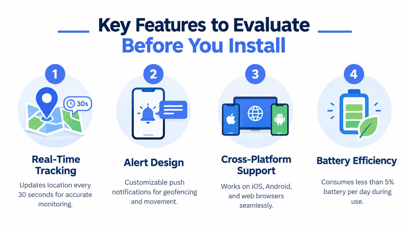
App-store descriptions often use “real-time” loosely. Before installing, test the product against four practical questions: how fresh is the location, how useful are the alerts, which devices can participate, and what control do you retain over the data?
Real-time tracking
Look for a visible update state, timestamp, route history, and a warning when the location is stale. A good interface should distinguish an active signal from a last-known position. Ask whether the app keeps working when the user is indoors, moving between networks, or conserving battery.
A route that silently stops is more dangerous than a route that clearly reports degraded coverage. Location should be treated as a probabilistic safety signal, not an exact point.
Alert design
Alerts need to help someone decide what to do next. Useful examples include departure, arrival, missed check-in, movement outside an expected route, low battery, and loss of communication. Test whether watchers can acknowledge or respond to an alert without opening several screens.
For families supporting an older adult, a practical resource such as the Velma guide to senior check-ins can help frame the human routine around the technology. An app works better when people know who is watching and what happens after a missed response.
Cross-platform support
Check whether the user, watcher, and emergency contact need the same operating system. Browser access can matter when a trusted contact doesn’t own the same type of phone. Also check whether location sharing continues when the app is in the background, the screen is locked, or permissions change after an operating-system update.
A solution that works only on one person’s phone may fail at the exact moment another person needs to help. Read permission requirements before you rely on it.
Privacy controls
Privacy isn’t just a settings page. It includes consent, visibility, retention, recording, access logs, and the ability to stop sharing without creating confusion. Look for features such as temporary hiding, explicit watcher lists, clear session status, and a documented deletion policy. Live location sharing should be understandable to the person being located, not hidden inside a permanent background process.
Consent also changes the use case. Sharing your route with a trusted contact is different from secretly attaching a tracker to another person. If an app records video or audio, ask who can view it, how long it remains available, and whether the user can stop or delete a session.
How Safety Apps Go Beyond a Map Dot
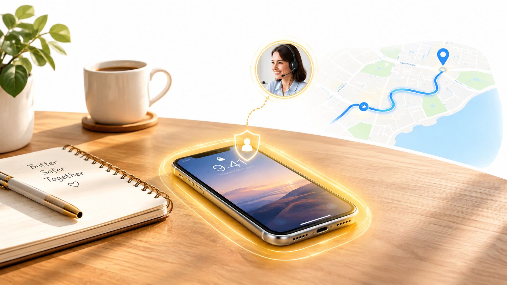
A map dot answers one narrow question: where did the phone report being? It doesn’t explain why the route changed, whether the person can respond, or whether anyone is actively watching. A safety app adds people and procedures around the location signal.
Consider a rideshare at night. The passenger shares a route with selected contacts. The vehicle turns away from the expected path, and the passenger stops replying. A watcher who can see the route and an approved live camera feed has more context than someone checking an occasional location refresh. A trained Safety Agent can help assess the situation, contact the user, and escalate when the available information indicates a serious emergency.
From SOS to context delivery
An SOS button is only the start of an emergency workflow. The useful package may include the current and recent location, route direction, emergency type, callback identity, entry instructions, watcher status, and a transcript or summary when recording is enabled. The system should show whether each handoff succeeded and how fresh the data is.
That context matters beyond rideshares. The U.S. Bureau of Labor Statistics recorded 5,070 fatal occupational injuries in 2024, a 4.0% decrease from 5,283 in 2023, with transportation incidents remaining the leading fatal-event category at 1,937 fatalities. Those figures explain why route visibility, check-ins, and escalation are relevant to delivery workers, field technicians, construction teams, healthcare staff, and other mobile workers.
A personal safety service may also preserve a recording and transcript for later review. That evidence needs access controls, time synchronization, and a retention policy. It should support emergency services, not replace a direct call to them when immediate help is required.
Where Remote Finder Apps Quietly Break
The largest network isn’t automatically the safest network. Bluetooth-finder networks depend on nearby participating phones and cannot provide continuous, guaranteed tracking, especially in rural, enclosed, or low-traffic areas, as described in this overview of Find Hub-compatible trackers.
Five failure modes appear repeatedly:
- Stale last-known locations: The map may show where the device was seen rather than where it is now.
- Dead batteries: A tracker or phone can’t report movement after its power runs out.
- Disabled permissions: Location, Bluetooth, notifications, or background access may have been turned off.
- Poor indoor positioning: A coordinate can identify the correct building without identifying the entrance, floor, or room.
- No nearby relay device: A crowdsourced tracker may remain invisible when no participating phone passes close enough.
A larger crowdsourced network can improve the chance of recovering an object. It doesn’t turn intermittent detection into live safety coverage.
This is why a remote finder app should display uncertainty and freshness instead of presenting every point as equally reliable. A useful safety workflow keeps the last reliable fix, recent movement, heading, and available address context together. If GPS degrades indoors, responders may need an entrance or suite detail rather than another decimal coordinate.
Privacy protections have their own limits. Unwanted-tracker alerts can be delayed, and independent digital-safety guidance reports that alerts may take up to 24 hours and that testing found some newer trackers weren’t always detected, according to Apple’s personal-safety guidance. An alert should prompt safe evidence preservation and support seeking, not an assumption that detection is immediate or complete.
Choosing the Right Solution for Your Situation
Use the situation, not the marketing category, to choose.
-
You lose keys or a bag around the house.
Choose an object tracker with a nearby Bluetooth signal, sound, and a compatible finding network. You need recovery, not continuous oversight. -
You frequently misplace your phone.
Start with the phone’s built-in finding service. Confirm that account access, location permissions, remote locking, and notification settings are ready before the next loss. -
A child walks home from school.
A phone finder may show the device, but a safety-focused workflow should also support consent-based route sharing, arrival confirmation, and a clear person to contact if the child stops responding. -
You take rideshares at night.
Prioritize live route sharing, visible watchers, communication, recording options, and escalation procedures. A last-known map position doesn’t provide enough context when a route changes unexpectedly. -
You work alone or travel between job sites.
Look for scheduled check-ins, movement prompts, route history, emergency entry information, and a staffed escalation path. The employer should explain who monitors alerts and how privacy is protected.
For the last two situations, 3rd-i is one personal safety option. It offers live video, audio, and location sharing with selected contacts and trained Safety Agents, along with features such as dual-camera streaming, watcher visibility, movement prompts, Critical Alerts, recording, and emergency escalation through RapidSOS. It remains a safety layer rather than a replacement for calling emergency services directly.
Choose a separate anti-stalking response plan as well. If an unwanted-tracker alert appears, preserve evidence, inspect belongings or a vehicle only when it’s safe, avoid confronting a suspected abuser alone, and seek local support. Technical detection tools can help, but they don’t remove the need for personal safety planning.
Making a Confident Final Choice
Start by naming the job. Object recovery is about finding keys, luggage, or another item. Phone location is about finding, ringing, or securing a connected device. Continuous human oversight is about watching movement, maintaining communication, interpreting context, and escalating when a person may be in danger.
Then identify the failure that matters most. If you’re recovering an object, the main concern may be a dead battery or the absence of a nearby relay phone. If you’re locating a device indoors, poor positioning and stale data may matter more. If you’re supervising a person, the critical questions are who receives the signal, whether they can communicate, and what happens when the user can’t respond.
A strong final check is simple:
If this tool fails at the worst possible moment, what information and human response remain available?
The answer should include more than a coloured dot. You may need a last reliable location, route direction, a callback identity, entrance details, a watcher, a Safety Agent, or a direct instruction to contact emergency services. You should also know when sharing starts, when it ends, who can see it, and how recordings are handled.
Personal safety apps such as 3rd-i exist because live human visibility is a different category from object retrieval. If your need is continuous oversight during a late walk, rideshare, commute, or lone-working shift, evaluate the people and escalation process as carefully as the positioning technology.
3rd-i offers live sharing of video, audio, and location with selected contacts and trained Safety Agents, plus route visibility and emergency escalation through RapidSOS. Review how it fits your safety scenario and visit 3rd-i to explore the service.